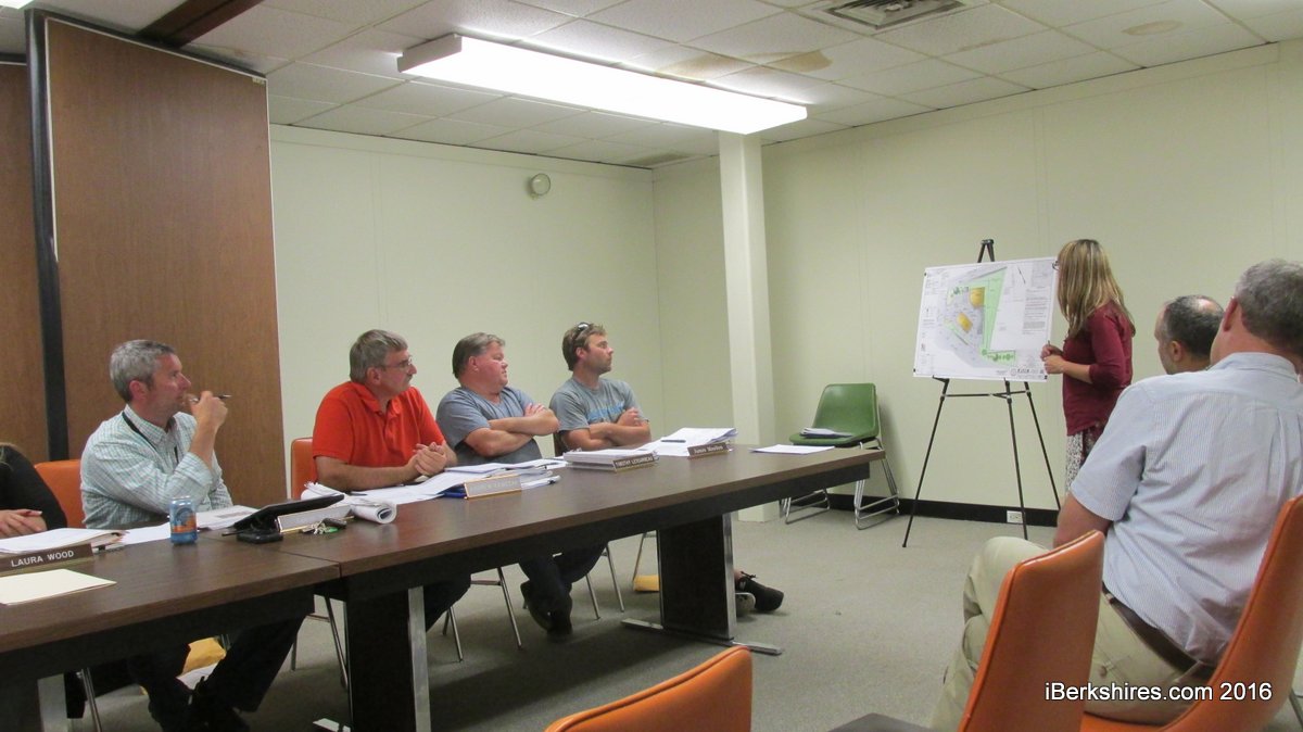
Emily Stockman explains some of the changes at 140 Eagle St. to the Conservation Commission.
NORTH ADAMS, Mass. — Plans to redevelop the corner of Canal and Eagle streets passed its first hurdle on Monday night.
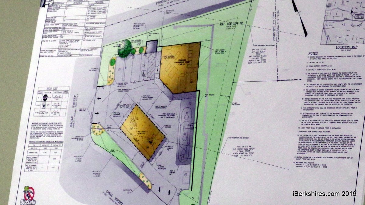
The Conservation Commission accepted the Notice of Intent submitted by Thomas Frawley of Summit Distributing LLC, based in Lebanon, N.H., for a new convenience store and gas pumps at 140 Eagle St.
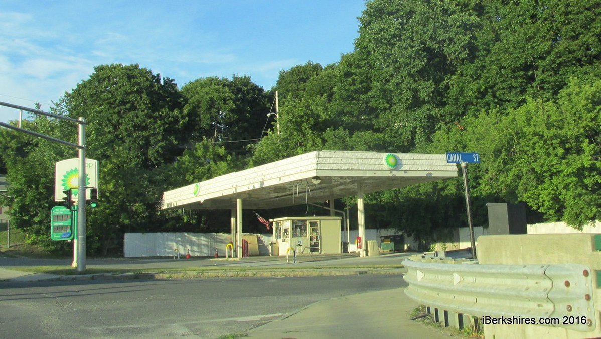
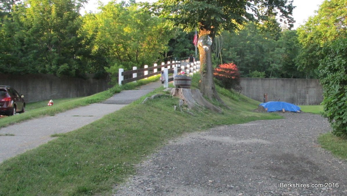
The city has been pressuring the owners to do something with the property, which hasn't had gas in years. A single small kiosk dating to the 1970s has been purveying cigarettes and other merchandise.
Summit, which is also redeveloping the Getty station in the West End, plans to tear down the kiosk and the pump canopies and build a new 1,400 square-foot convenience store tucked into the northeast corner of the 1/2-acre property. The new pumps would be on the Canal Street side, near the riverfront.
Emily Stockman, of Stockman Associates in Adams, said there were some areas of improvement that could be taken on the property.
"Rather than take advantage of the full degraded and impervious footprint they've been able to reduce the impervious surface by about 556 square feet," she said. "The other thing we've been able to do in compliance with [state law] is to meet the redevelopment standards for water."
There's currently invasive Norway maples on the property. Stockman said the plan is to install water-quality swales to direct the water flow to storm receptors and treatment centers. The areas would incorporate native plants with landscaping on the Eagle Street side, along Canal and in an odd corner on the southeast edge.
"We don't trigger anything for remediation," she said, calling the green areas "good faith" plantings. "There is no formal mitigation because we don't exceed the 10 percent and we're reducing the area."
MHF Design consultant Huseyin Sevincgil said the stormwater is currently draining directly into the flood control chute. With the swales and the new system, much of the water will be cleaned before exiting into the river.
"There's an existing retaining wall that was part of a factory ... we're keeping this wall intact and were positioning our station as close to the wall as possible and filling in behind," he said.
The commission approved the NOI with the caveat that it receive further documentation on three comments made by the Department of Environmental Protection regarding stormwater and infiltration.
Commissioner Andrew Kawczak wondered why the stockade fence and canopies were being painted if the whole thing was going to be demolished. Frawley said that had to do with the "other side" of City Hall and the owners desire to continue operations at the site.
The Planning Board has been considering whether the former BP station's permit is still active considering there's no gasoline being sold. The board also pushed back in April for the property to be cleaned up.
The site plan is expected to go before the planners next month. Frawley said he hoped to begin work this construction season.
"I think it's a fantastic improvement to that whole intersection," said Commissioner Jeffrey Meehan.
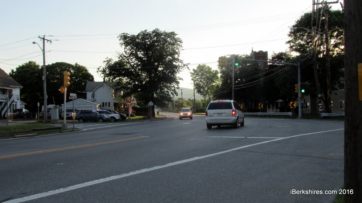
The state Department of Transportation's proposed upgrades at the intersection of Phelps Avenue and Route 2 were continued until the next meeting to give the state time to provide more information.
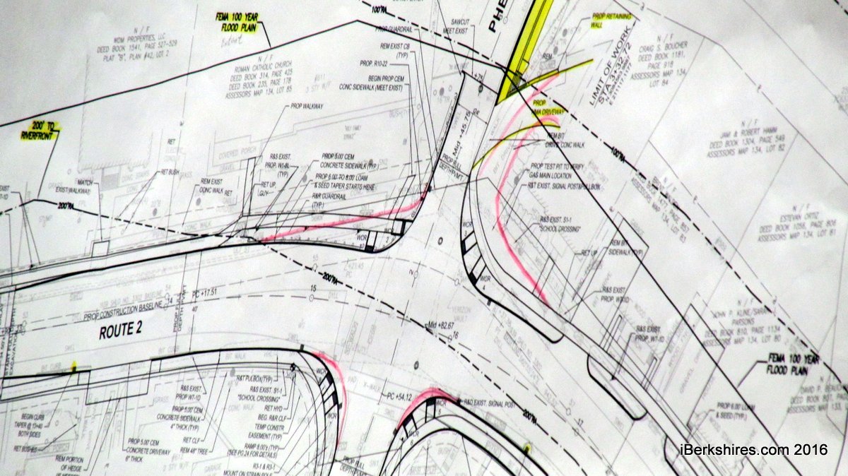
Amer Raza, a design engineer with District 1, said the changes are being prompted by a number of motor vehicle crashes from westbound traffic at the curving intersection.
"Most of these crashes were because of the sharp radius of this curve," Raza said. "What we are proposing, we will be doing minor curb realignment in this area ... there will be a new alignment of the intersection so it's a little more straight here."
The estimated $1.2 million upgrade will include grading, new traffic signals, curbing, new catch basins, the repositioning of a private driveway that exits into the intersection, and addressing Americans With Disabilities compliance regarding the crossings and the footbridge over the Hoosic River.
The project is not expected to be bid until next year and scheduled for construction in fall 2017. It is being funded through the Metropolitan Planning Organization's 2017 Transportation Improvement Program.
The application is a Request for Determination of Applicability because some construction will fall within the 100-year floodplain of Hoosic River.
The commissioners were not completely satisfied that the state had calculated in the compensatory [floodwater] storage in the design, noting the project would add 10 cubic yards into the area. Raza said the new retaining wall was above the 100-year flood line and the work being done would be below it. But Chairman Jason Moran said he couldn't find anything in the state's law about a retaining wall exempting the need for compensatory storage.
Kawczak was concerned that there would still be underground systems connected to the river.
"I don't think the documentation packet we currently have defines and necessarily controls," Kawczak said. "We want to be generous, magnanimous about trust but our role here is to try and ferret out the facts and try to pour resolutions in concrete and not Jell-O."
Chairman Jason Moran agreed, saying there was time in the process to get "that rock solid evidence that we've seen in the past."
"I think they need to show us the calculations of what's being moved," said Commissioner Timothy Lescarbeau. "I would treat it like the wall is not there."
Raza asked that the hearing be continued so the state could address their concerns.
In other business:
• A hearing on the Airport Commission's plans for a new administrative building was deferred to the commission's August meeting at the request of the applicant.
• A permit first issued in 2006 for building two driveways on land off Bradley Street was extended for Margaret Parsons. The land is expected to be sold and the permit was considered critical to the sale.
northadams.com welcomes critical, respectful dialogue. Name-calling, personal attacks, libel, slander or foul language is not allowed. All comments are reviewed before posting and will be deleted or edited as necessary.